Flood Early Warning System (BFEWS)
Autonomous solar-powered river and reservoir monitoring system delivering sub-millimeter level sensing, predictive surge algorithms, and multi-tier emergency alerts before floodwaters strike.
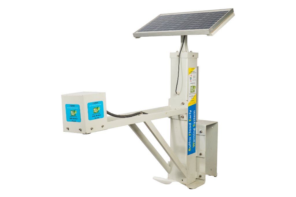
Autonomous River Level Telemetry & Rapid Flood Evacuation
Standard river gauges fail when debris surges strike bridge piers. The BULFRO BFEWS deploys elevated non-contact radar sensing and independent solar generation to keep critical disaster command centers informed 24/7.
Why Flood Defense Relies on Non-Contact Sensing
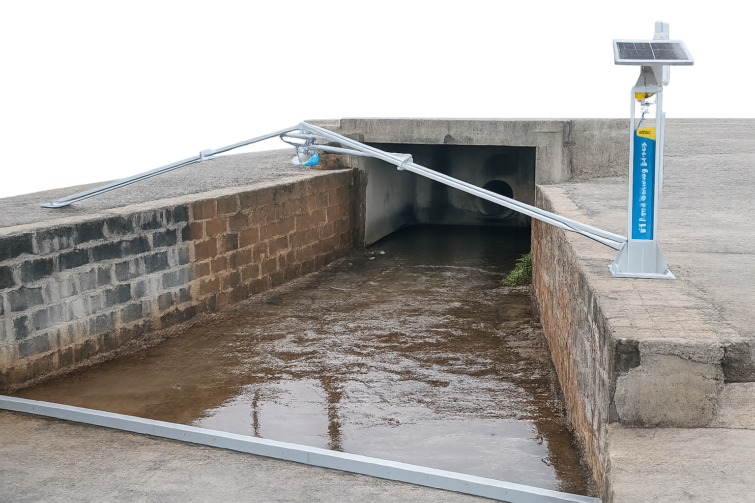
Rivers during flash floods carry heavy debris, fallen trees, and silt sediments that destroy submerged pressure transducers within minutes. The BULFRO Flood Early Warning System mounts high above the flood line on bridge spans, cantilevers, or river embankments, projecting narrow-beam FMCW radar pulses down to the surface with sub-millimeter precision.
Equipped with an intelligent hydrological edge processor, BFEWS calculates river stage velocity, rate of rise (m/hr), and compares current flow regimes against historical hydraulic curves. The moment rate-of-rise thresholds are breached, emergency SMS alerts, automated siren contacts, and cloud telemetry kick in within seconds.
BULFRO Hydrological Observation in Extreme Monsoon Conditions
Witness how Bulfro hydrological telemetry stations measure surging water levels and broadcast telemetry through cloud dashboards under severe weather conditions.
6 Core Pillars of BFEWS Reliability
Designed specifically for unassisted operation in remote mountain rivers, floodplains, dam spillways, and urban drainage choke points.
FMCW Non-Contact Radar
High-frequency 80 GHz / 24 GHz narrow-beam radar measures surface distance up to 30 meters with ±2 mm accuracy, unaffected by heavy rain, fog, wind-whipped waves, or thermal air gradients.
Narrow 8° Beam Angle15-Day Solar Autonomy
Integrated 40W industrial-grade monocrystalline solar panel coupled with a 12V 24Ah LiFePO4 battery pack guarantees 15+ consecutive days of full continuous telemetry even during continuous monsoon overcast.
LiFePO4 Chemistry • 3000+ CyclesMulti-Tier Alert Engine
Edge microcontroller monitors both instantaneous level and rate-of-rise (cm/min). Automatic triggers dispatch instant SMS alerts to 20 key personnel, activate local sirens, and push emergency webhooks to district servers.
< 5s Emergency DispatchDual-SIM Multi-Bearer IoT
Redundant telemetry architecture featuring dual-carrier 4G LTE-M / NB-IoT with automatic carrier handover. In remote gorges, optional LoRaWAN relays signals up to 15 km line-of-sight to town gateway nodes.
Dual-SIM • LoRaWAN ReadyIP67 / IP68 Bridge-Mount Build
Marine-grade powder-coated aluminum data logger enclosure (IP67) with completely submersible radar sensor head (IP68). Designed to withstand 150 km/h wind gusts, lightning strikes, and corrosive river mist.
Marine-Grade SS316 MountingsCloud Hydrology & GIS Analytics
Direct integration with the Bulfro Cloud platform provides live GIS river basin maps, stage-discharge rating curves, historical hydrographs, and automated compliance export for state disaster authorities.
Bulfro Cloud • REST API / MQTTEngineering Data
Technical Specifications
| Parameter | Specification |
|---|---|
| Sensor Technology | Non-Contact FMCW Radar (24 GHz / 80 GHz) / High-Power Ultrasonic |
| Measurement Range | 0.3 m to 15 m (Standard) | Up to 30 m (High-Span Bridge Edition) |
| Resolution & Accuracy | Resolution: 1 mm | Accuracy: ±2 mm (Radar) / ±0.25% FS |
| Radar Beam Angle | 8° Narrow Cone (80 GHz) / 12° (24 GHz) eliminating false echoes |
| Telemetry Interval | 1 Hz sampling; 1-min to 24-hr upload (10-sec in emergency mode) |
| Onboard Intelligence | Rate-of-rise computation, wave dampening filter, flash surge detector |
| Cellular & Wireless | 4G LTE Cat-M1 / NB-IoT / 2G Fallback | LoRaWAN | RS-485 Modbus |
| Emergency Alerting | Multi-Tier SMS (20 recipients), dry-contact relay for siren/beacon |
| Power Management | 40W Solar PV Panel + 12V 24Ah LiFePO4 battery (> 15 days autonomy) |
| Ingress Protection | Enclosure: IP67 NEMA 4X aluminum | Radar Horn: IP68 Submersible |
| Certifications | WMO No. 168 Hydrology Standards, CWC & SDMA Benchmarks, CE, RoHS |
Media Gallery
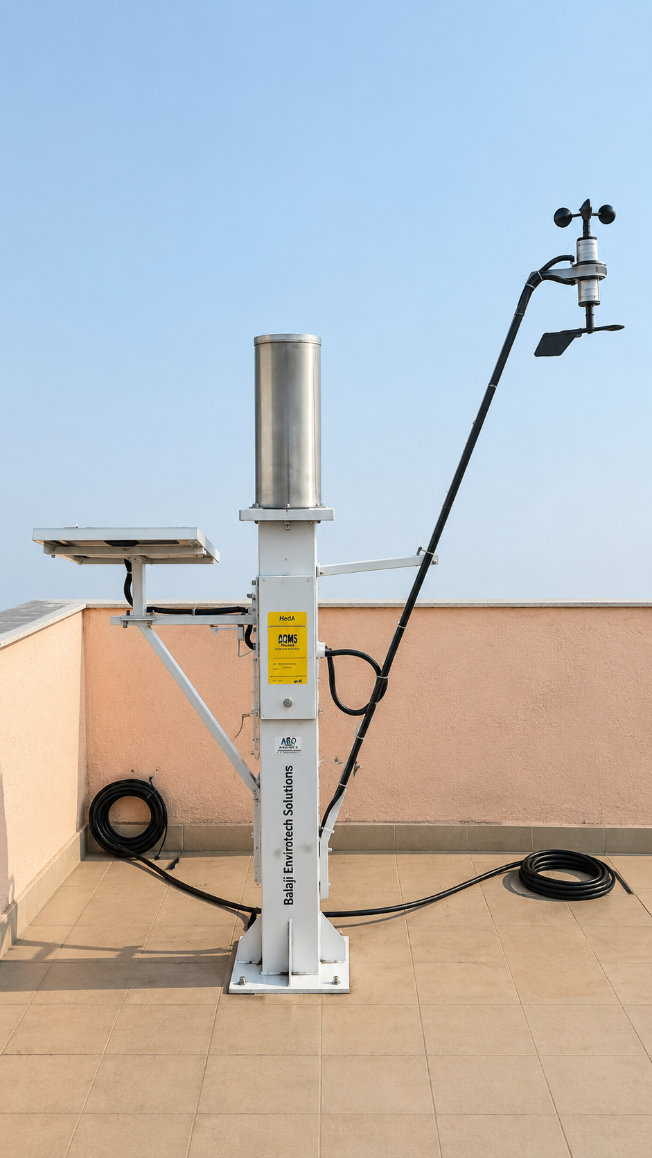
Field Stations & Radar Nodes
Select Your BFEWS Configuration
Choose the right sensor span, mounting style, and telemetry package tailored to your river topography.
BFEWS-900S
Ideal for river banks, streams, agricultural floodplains, and municipal drains.
- Level Range: 0.3 m to 15 m
- Sensor Type: 24 GHz Non-Contact FMCW Radar
- Telemetry: 4G LTE-M / NB-IoT
- Power: 40W Solar Panel + 18Ah LiFePO4
- Mount: Riverbank mast or cantilever post
- Alerts: Cloud push + SMS to 10 contacts
BFEWS-900X
Designed for major river bridges, deep gorges, and wide highway spans.
- Level Range: 0.3 m to 30 m
- Sensor Type: 80 GHz Ultra-Narrow 8° Radar
- Telemetry: Dual-SIM 4G + LoRaWAN Fallback
- Power: 60W Solar Panel + 24Ah LiFePO4
- Mount: Heavy-duty bridge parapet clamp arm
- Alerts: SMS (20 contacts) + Audio Siren Relay
BFEWS-900D
Full-suite hydro-meteorological station for dam reservoirs, barrages, and city command centers.
- Level Range: Dual Radar (0.3m–30m) + Tipping Rain Gauge
- Sensor Type: 80 GHz Radar + 0.2mm Rain Gauge
- Telemetry: 4G + RS-485 Modbus + Ethernet / Satellite
- Power: 80W Solar + AC Mains Dual Backup
- Mount: 3-meter triangular guyed tower
- Alerts: Multi-Tier High-Decibel Siren Tower + SMS
Frequently Asked Questions
Frequently Asked Questions
Answers to technical, operational, and deployment questions regarding the BULFRO Flood Early Warning System.
Submerged hydrostatic pressure sensors in rivers are routinely buried by silt, entangled by tree branches, or torn away by strong underwater currents during monsoon flash floods. The BFEWS radar sensor is installed safely above the highest recorded water level on bridge decks or cantilever posts. It never touches water or debris, ensuring zero mechanical wear, zero clogging, and uninterrupted operation when you need it most.
The 80 GHz FMCW radar pulses pass through torrential rain, dense fog, smoke, and air temperature gradients with virtually zero attenuation (unlike optical or ultrasonic sensors). Furthermore, the internal edge processor executes a high-speed digital filtering algorithm that averages rapid wind chop and wave reflections over a user-configurable window (e.g. 10 to 30 seconds), delivering stable and true hydrological stage values.
BFEWS incorporates three layers of failover protection:
1. Local Edge Autonomy: Even if cellular data completely drops, the onboard controller can still trip local high-decibel siren relays and send emergency direct SMS messages over 2G GSM bands.
2. Non-Volatile Storage: Up to 10 million readings are stored on an industrial 32GB SD card and automatically synced back to the Bulfro Cloud as soon as connectivity resumes.
3. Optional LoRaWAN / Satellite: Long-range LoRaWAN can transmit stage telemetry up to 15 km to an emergency municipal post outside the flood zone, or an optional Iridium satellite modem can be integrated.
Thresholds can be set both in absolute water depth (meters above river bed or datum elevation) and dynamic rate-of-rise (e.g. rising faster than 15 cm in 10 minutes). The system provides 4 discrete escalation tiers. When an alert condition is validated, alerts are dispatched within 5 seconds via SMS to designated disaster coordinators, push notifications to the mobile app, and automatic audio-visual sirens at the site.
The entire BFEWS station operates completely off-grid. The standard unit comes with a 40W monocrystalline solar panel and an internal 12V 24Ah Lithium Iron Phosphate (LiFePO4) battery pack. Thanks to intelligent micro-power power cycling, the station delivers 15+ consecutive days of full continuous telemetry even if there is total cloud cover or zero sunlight throughout the monsoon period.
Yes. BFEWS supports open industry communication protocols. Data can be transmitted via standard MQTT broker feeds, REST APIs, or Modbus RS-485 directly into municipal Integrated Command and Control Centers (ICCC), Central Water Commission (CWC) portals, and State Disaster Management Authority (SDMA) databases.